Geography

Shipping Company Route Map from 1889
This route-map of the Messageries Maritimes shipping company displays the main routes connecting metropolitan France to its empire in the Indo-Pacific. While the map dates to 1889, these routes retained their basic structure through the 1950s.
Mandate for Palestine
The Mandate for Palestine was a legal document that established the United Kingdom as a Mandatory in charge of Palestine and Tran

List of Foreign Arrivals in the Port of Zanzibar from the 16th September 1832 to 26th May 1835
This is an ostensibly mundane document that contains a tremendous amount of information for interpreting the global dynamics of this period of history, all while peering out into the world from the tiny island of Zanzibar.
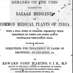
Edward Waring on Assafœtida as medicine in India
Medical publications appealed to a medical and popular audience in the hopes of providing surgeons with tips on how to obtain similar drugs and medicine in local bazaars which could not be obtained elsewhere.
Short Teaching Module: Global Microhistory and the Nineteenth-Century Omani Empire
In their primer essay, Jessica Hanser and Adam Clulow note how scholars of global microhistory explore relationships between macro and micro, deep structures and contingency, and big state actors and minor players.

Short Teaching Module: Spatial Histories of Law, Race and Empire
Law is not only to be found in doctrine and documents, but also in structures and materials, in buildings and in cloth, in paintings and in photos.
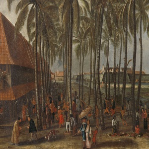
The Batavia Castle
Seventeenth-century market in the city Batavia (nowadays Jakarta, Indonesia), the central node of Dutch imperial activities in the Indian Ocean region. The Batavia Castle is visible in the background and to its right the Council of Justice with the gallows and whipping post in front of it.
Mikhail Gorbachev’s Resignation Speech
This is a transcript of Gorbachev’s resignation speech. This speech signified the complete end of the Soviet Union. According to the speech, what reasons does Gorbachev give for his resignation? What is the overall tone of this document? Why do you think Gorbachev uses this tone?
Long Teaching Module: Border Changes of the Soviet Union
Border changes have been a central part of 20th century European history. This lesson will examine a few key maps and documents that explore the creation, expansion, and dissolution of the Soviet Union.
The Alma-Ata Declaration
This document is a translation of the Belovezh Accords, the agreement which essentially declared that the Soviet Union ceased to exist. Those who signed it agreed to form a Commonwealth of Independent States (CIS). Which states were signatories of the Belovezh Accords?