Geography

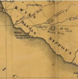
Map of the Treaty of Fort Stanwix, 1768
In 1768, Sir William Johnson received permission from the British Crown to hold a treaty council with the Iroquois Confederacy and its dependents in order to establish a more official and lasting boundary line without French pressures.

Short Teaching Module: Premodern Chinese Maps and the Global Maritime World
Premodern Chinese maps offer fascinating sources for teachers and students of world history.

Selden Map
The Selden Map held by the Bodleian Library in Oxford, where it has been kept since 1659. This beautifully illustrated manuscript map shows East and Southeast Asia and marks maritime trading routes in the form of lines across the region.
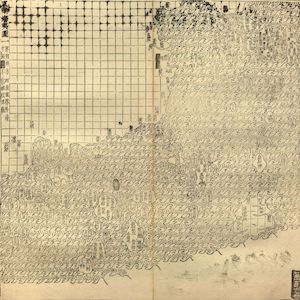
Guang yutu map
The map of the “South-Eastern ocean barbarians” from the 1558 edition of the atlas Guang yutu. This atlas is divided into two parts, the first one deals with the geography of China, the second one with the Chinese borderlands, thematic maps, and maps of non-Chinese regions.
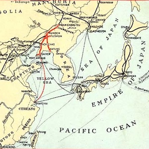
Southern Manchuria Railway (1906-1945)
The world’s earliest locomotive-operated railroads, short stretches transporting coal and ore locally from mines to factories and furnaces, were developed in Britain between 1800 and 1825.
Short Teaching Module: Shared Space, Shared Experiences: Transnational Water Management around the Great Lakes
World historians sometimes work within a single sub-field, such as migration history or gender history, but they can also bring sub-fields together, as their perspectives, methods, and subject matter cross boundaries.
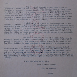
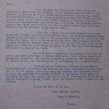
Emmerton Letter, 1926
Between 1919 and 1935, citizens of the U.S. and Canada complained about industrial pollution from an American company called the Solvay Process Company (also called the Michigan Alkali Corporation), which dumped its wastes on Fighting Island, in the Detroit River.
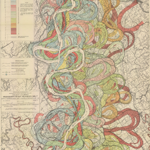
Ancient Courses: Mississippi River Meander Belt
This is one of fifteen maps of the Mississippi River created by cartographer and geologist Dr. Harold N. Fisk in 1944. The maps were part of Fisk's Geological Investigation of the Alluvial Valley of the Lower Mississippi River for the U.S. Army Corp of Engineers.

Primer: The History of Globalization
Globalization, defined here as the integration of an interdependent economy that simultaneously enhances cultural exchanges relying on the mobility of people, animals, plants, pathogens, objects, and ideas, is a useful concept for exploring connections across space and time.