Geography

Act of Declaration of Independence of Ukraine
This source is one example of a former Soviet republic declaring its independence from the Soviet Union. Who created this document? What reasons does the document creator give for wanting to secede from the Soviet Union?

History of NATO Expansion Map
This map shows the expansion of NATO over time. Have students identify the most recently states to join NATO. Which states have joined NATO after the collapse of communism? Which of these newer NATO states had been Soviet satellite states as opposed to full republics of the Soviet Union?

Cold War Europe Military Alliances Map
This map illustrates which states in Europe belonged to NATO or the Warsaw Pact military alliance. The white states were neutral. This map illustrates the infamous Iron Curtain and the split between West and East. Which of these states belonged to the Warsaw Pact?

Map of Europe, 1918
This map illustrates European borders prior to the start of WWI in 1914 with black lines and new states formed by the First World War in red. As the map illustrates, a number of states became independent from Tsarist Russia. What new states were these?
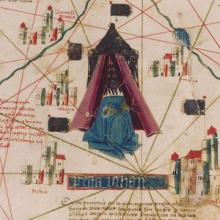
Short Teaching Module: Examining Early Genoese Voyages through Maps
The medieval Genoese ranged from China to the Atlantic, and their experience in navigation, the sugar industry, and the slave trade were the elemental foundation of Iberian colonial expansion.
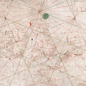
Nautical Chart, 1385
This nautical chart is signed by Majorcan cartographer Guglielmo Soler and dated to 1385, and ranges from the Black Sea to the Atlantic. Less beautiful than the Catalan map, it was also more practical for navigators to use.
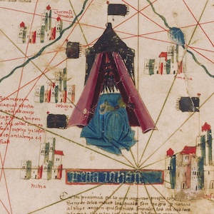
Catalan Map of the World, c.1450
Dated to the mid-fifteenth century, this Catalan world map is over a meter in diameter on a sheet of vellum (high-quality parchment made of calfskin). Unlike many other surviving charts, this was not meant for practical navigation, though it was based on such nautical charts.
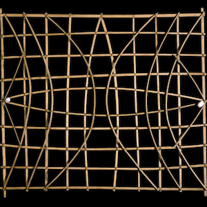
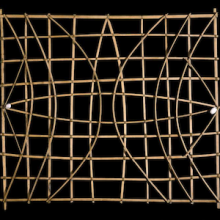
Marshall Islands stick chart
Across millennia, Pacific people voyaged out to sea and settled the ocean’s thousands islands and atolls, linking new discoveries back to existing territories.
Short Teaching Module: History of the Pacific Ocean
Scholars of Pacific history explore how people build lives dependent on the ocean, how maritime connections create communities, and how humans and the environment shape each other.
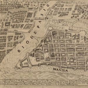
Map of the Philippines, 1734
The city of Manila is a perfect place to think about the importance of cities to world history.