Maps of Liberia, 1830 to 1870
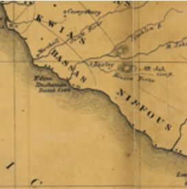
The Maps of Liberia, 1830 to 1870 collection at the Library of Congress is an online collection of maps created and used by the American Colonization Society. This society was created in order to send freed African Americans to Africa, as an alternative to emancipation in the United States, to the colony that would eventually become the independent state of Liberia. The maps that are held in this collection show the area that were first settled, as well as sovereign indigenous areas or areas that they may have ceded, and some buildings that settlers used. The collection also includes articles and essays related to the history of the colony and the eventual sovereign state, as well as guides on how to read maps, and links to other collections (such as the America's First Look into the Camera Collection) that hold materials either in the Maps to Liberia collection or related to it.
Beyond this collection, the Library of Congress website is an open-access resource available for students and teachers to browse. It boasts a wide selection of documents, many of which are free to use. These documents include photographs, books, films, web archives, legislation and more, from a range of subjects and time periods. The Library of Congress also offers some lesson plans making use of primary sources they host, a blog describing teaching methods, and other resources to enhance both the student and teacher experience. These resources, combined with its easy to use platform, make it, as well as this collection, great resources and guides for use in the classroom.
This collection offers a unique opportunity to study black history and culture, both in the diaspora as well as in Africa itself. It also allows students to study colonization, and the sometimes complicated conversations that arise out of colonial efforts and their purposes. Students will also have exposure to practical skills such as map reading and interpreting the purpose and audience of certain types of documents.
How to Cite This Source
"Maps of Liberia, 1830 to 1870," in in World History Commons, https://worldhistorycommons.org/maps-liberia-1830-1870 [accessed March 31, 2026]