Primary Source
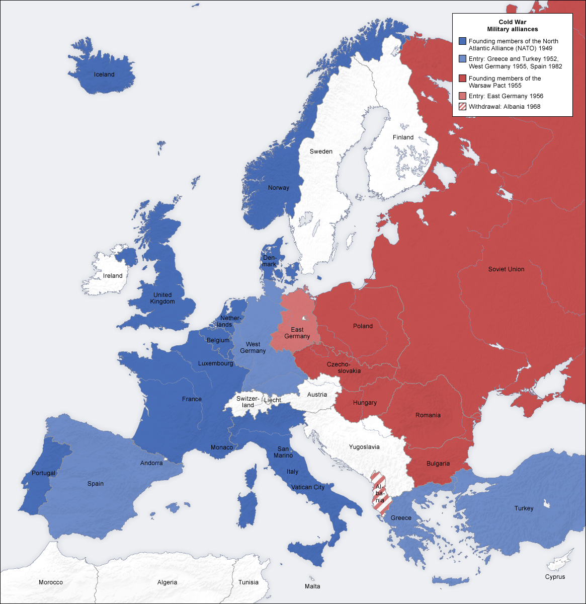
Cold War Europe Military Alliances Map
Annotation
This map illustrates which states in Europe belonged to NATO or the Warsaw Pact military alliance. The white states were neutral. This map illustrates the infamous Iron Curtain and the split between West and East. Which of these states belonged to the Warsaw Pact? For the states that belonged to the Warsaw Pact, were they satellite states or republics of the Soviet Union? Compare your list of Warsaw Pact states with the new NATO states illustrated on this map. Which states had been Warsaw Pact states and now belong to NATO?
This source is part of the teaching module on border changes of the Soviet Union.
Credits
From Wikimedia Commons, https://commons.wikimedia.org/wiki/File:Cold_war_europe_military_alliances_map_en.png