Catalan Map of the World, c.1450
Annotation
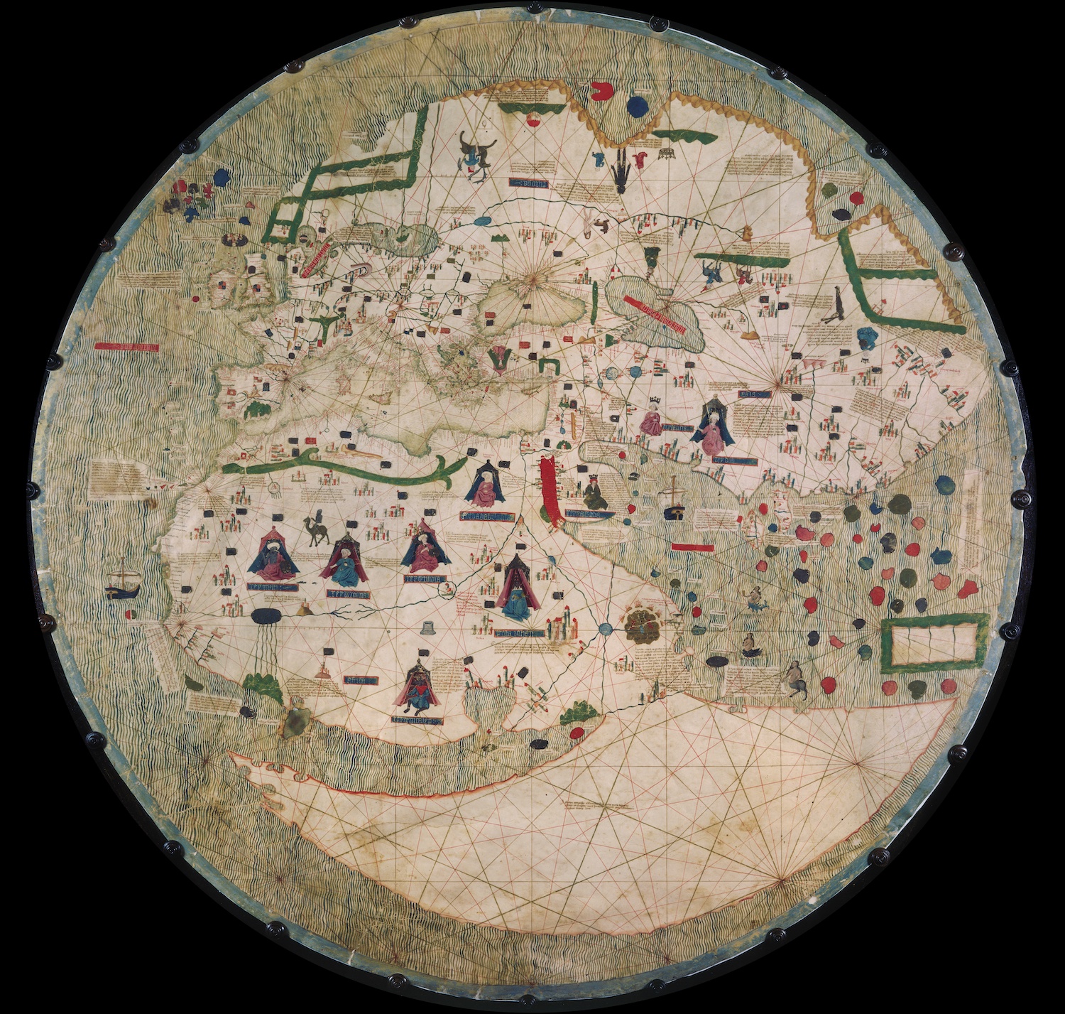
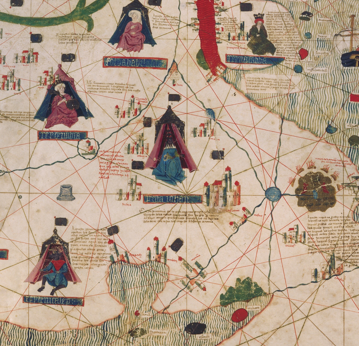
Dated to the mid-fifteenth century, this Catalan world map is over a meter in diameter on a sheet of vellum (high-quality parchment made of calfskin). Unlike many other surviving charts, this was not meant for practical navigation, though it was based on such nautical charts. Unlike most previous medieval maps, Jerusalem is not at the center – though the crusading ethos remains, as the center of the map is near the mythical land of Prester John. Rendered here as Presta Iohan, whom the artist depicts between two branches of the upper Nile. (see the inset image below the image of the main map). Prester John was a mythical Christian king of the east, variously located in Ethiopia or India, who crusaders hoped would soon join in the fight against Islam.
This source is part of the examining early Genoese voyages through maps teaching module.
Credits
From the Biblioteca Estense Universitaria (BEU) in Modena, Italy (call number C.G.A.1)