Nautical Chart, 1385
Annotation
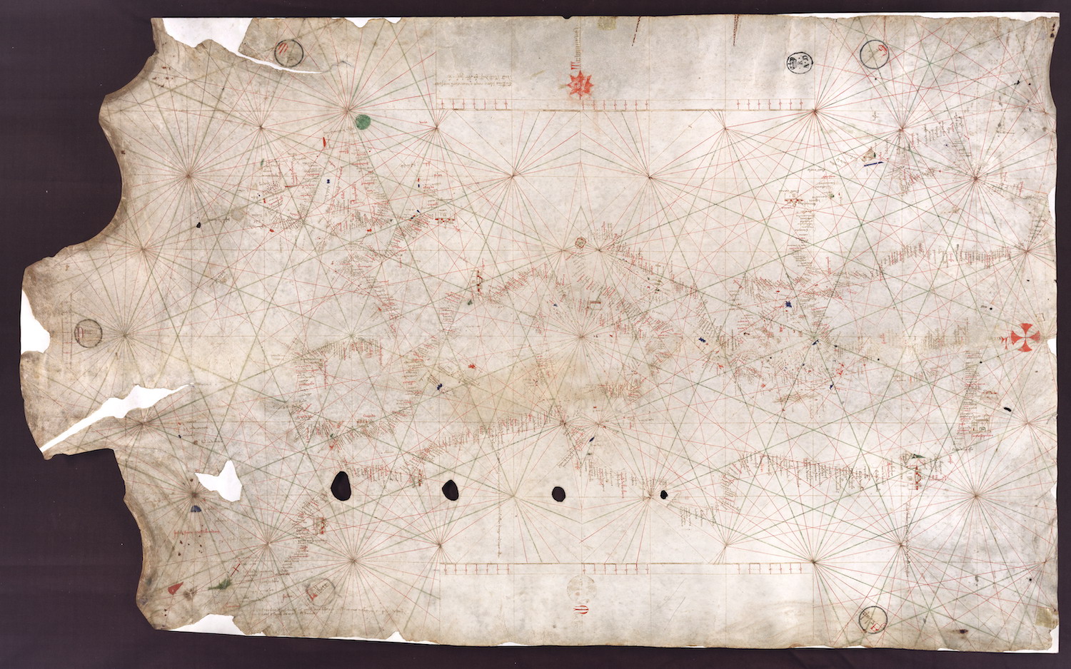
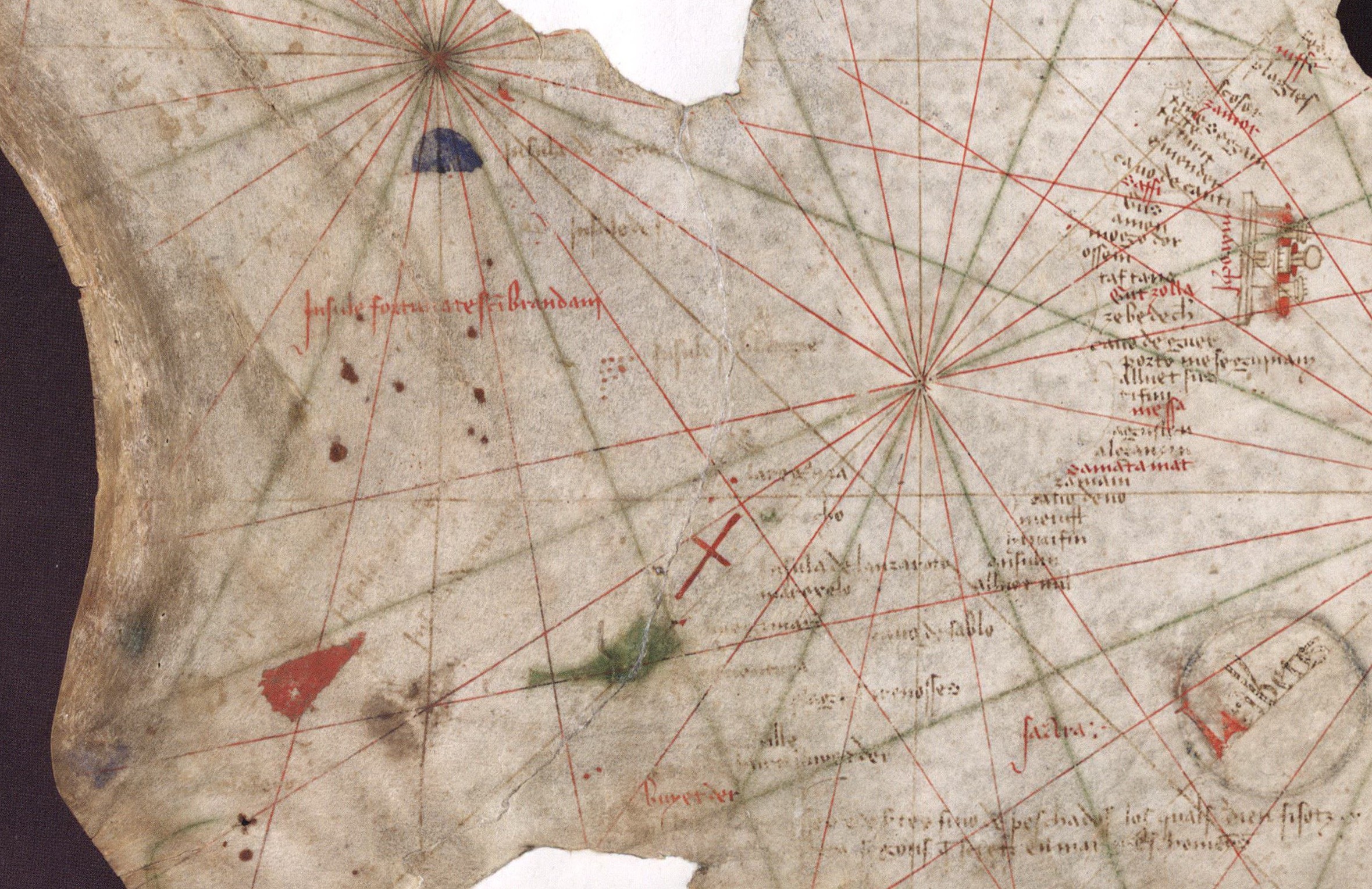
This nautical chart is signed by Majorcan cartographer Guglielmo Soler and dated to 1385, and ranges from the Black Sea to the Atlantic. Less beautiful than the Catalan map, it was also more practical for navigators to use. Note the succession of steadily larger holes across the bottom, perhaps made as the map was loosely rolled and then hung on a hook. Note also the networks of lines radiating outwards from various points on the map (see the inset image below the image of the main map which shows close-up of the island of Lanzarote in the Canaries). These lines were used as navigation aids.
This source is part of the examining early Genoese voyages through maps teaching module.
Credits
From the Archivio di Stato di Firenze, Carte nautiche, 3, folio 3r.