Travel
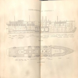
Ship Plan of a Late-19th Century Steamship
This ship plan from the late-19th century offers a partial view of spatial arrangements within a Messageries steamship.

Shipping Company Route Map from 1889
This route-map of the Messageries Maritimes shipping company displays the main routes connecting metropolitan France to its empire in the Indo-Pacific. While the map dates to 1889, these routes retained their basic structure through the 1950s.

Short Teaching Module: Global Microhistory and the Nineteenth-Century Omani Empire
In their primer essay, Jessica Hanser and Adam Clulow note how scholars of global microhistory explore relationships between macro and micro, deep structures and contingency, and big state actors and minor players.
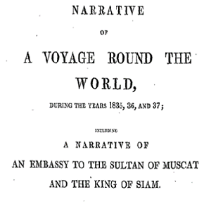
Memoir of William Ruschenberger
Dr. William Ruschenberger (d. 1895) was a United States Navy surgeon and was assigned to the USS Peacock, serving with Edmund Roberts as part of an American delegation representing the Jackson Administration to negotiate treaties with the Omani Empire and the Kingdom of Siam.
Short Teaching Module: Spatial Histories of Law, Race and Empire
Law is not only to be found in doctrine and documents, but also in structures and materials, in buildings and in cloth, in paintings and in photos.

Short Teaching Module: Global Approaches to Maritime Trade in Colonial North America
Traditional narratives in American history, especially in colonial history, tend to focus primarily on British policy and British trade networks. Taking a global approach to the maritime trade of British America in the colonial era provides a better understanding of the actual economy, however.
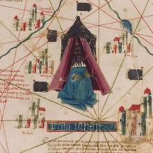
Short Teaching Module: Examining Early Genoese Voyages through Maps
The medieval Genoese ranged from China to the Atlantic, and their experience in navigation, the sugar industry, and the slave trade were the elemental foundation of Iberian colonial expansion.
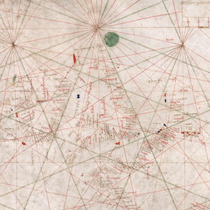
Nautical Chart, 1385
This nautical chart is signed by Majorcan cartographer Guglielmo Soler and dated to 1385, and ranges from the Black Sea to the Atlantic. Less beautiful than the Catalan map, it was also more practical for navigators to use.

Primer: Borderlands History
Borderlands history studies the making and crossing of borders. While the term “borderlands” has no fixed definition, it can refer to spaces of encounter between different peoples and political entities.