Travel

Marshall Islands Stick Charts
The Marshall Island stick charts represent a unique and non-Western tradition of mapmaking.

Africae tabula noua
This standard map of Africa came from a popular Atlas in the late sixteenth century.

Res Obscura
Functioning primarily as the personal blog of historian Benjamin Breen, Res Obscura stays true to its by-line by being ‘a catalogue of obscure things’.
StoryMapJS: Maps that Tell Stories
A completed StoryMap will take you through a narrative that links text and media to locations on a map. Rather than simply clicking through points on a map, the tool is designed to create a narrative flow by clicking on an arrow to advance the story in a predetermined order.
Iceland Saga Map
Ultimately, the purpose of this map is to encourage and aid new readings of the sagas.
Kilwa Map Illustration
This illustration shows the trading city state of Kilwa or Kilwa Kiswani on an island off the Swahili Coast in East Africa (modern Tanzania), which flourished between the 12th and 15th century.

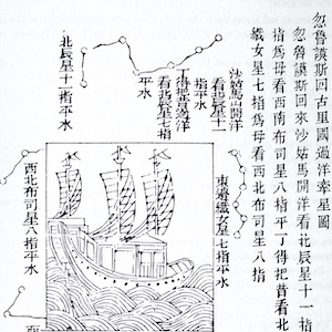
Navigational Charts Based on Those Used by Zheng He
These two woodblock prints are part of a map printed in a seventeenth-century military treatise, and thought to be based on the maps used by Zheng He in his voyages.
Excerpt from the Memoirs of Ma Huan
This excerpt is from the memoir of Ma Huan (1380-1460), a Chinese Muslim voyager and translator, who accompanied Admiral Zheng He on three of his seven voyages.
Excerpt from Ibn Battuta's Travels in Asia and Africa 1325-1354
This source comes from the travel book of Ibn Battuta (1304-1369), a Moroccan Berber scholar and explorer.
