Transportation

Long Teaching Module: Caribbean Seafaring in the Archaic Age (2000-400 BC)
There have been many different approaches to studying seafaring in the past. We can look at the evidence of voyages in books written by prominent explorers or follow the maps maintained by successful prominent trading companies.

Least Cost Pathway Analysis Showing Movement Across a Landscape
These side by side charts show the basics of how least cost pathway analysis works in action. A geographic surface, landscape or seascape, is broken into standard size squares (or cells).

Remains of the Stargate Canoe
This image showcases one of the few remains of a canoe found in the Caribbean. The ‘Stargate’ canoe, found in a blue hole—a large marine cavern--on the island of South San Andros in the Bahamas, represents only the tip of the canoe.

Short Teaching Module: Connecting the French Empire
For a long time, historians tended to study colonial empires of the 19th and 20th centuries one colony at a time, or through the relationship of one colony to its metropole.

Analyzing Travel Records
In a way, all historical thinking and all historical writing deal with travel accounts.

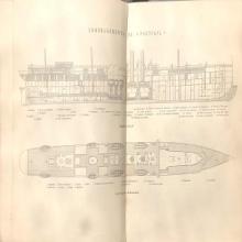
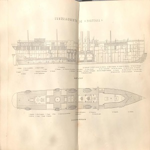
Ship Plan of a Late-19th Century Steamship
This ship plan from the late-19th century offers a partial view of spatial arrangements within a Messageries steamship.

Shipping Company Route Map from 1889
This route-map of the Messageries Maritimes shipping company displays the main routes connecting metropolitan France to its empire in the Indo-Pacific. While the map dates to 1889, these routes retained their basic structure through the 1950s.

List of Foreign Arrivals in the Port of Zanzibar from the 16th September 1832 to 26th May 1835
This is an ostensibly mundane document that contains a tremendous amount of information for interpreting the global dynamics of this period of history, all while peering out into the world from the tiny island of Zanzibar.

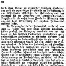
Ideal ration recipe
This is one page out of a notebook kept by Stephen Robinson Parsons, a somewhat improvement-minded farmer in South Paris, Maine. Around 1896, Stephen copied into his fact book an ideal ration:

Short Teaching Module: Agricultural Knowledge in the Late Nineteenth Century
Knowledge knows no national boundaries. Therefore, the history of knowledge also has to move beyond national boundaries to understand how knowledge was produced, moved, and adapted. Telling such a history without the limitations of national boundaries is challenging.