Transportation

Indian Ocean History
It is easily the most comprehensive website for studying and teaching Indian Ocean history currently available.
Trust Territory Photo Archives
The images in the collection are an extensive record of American views of Micronesian peoples, society, and culture and of the interaction between the United States and the Trust Territories.
Africa Focus: Sights and Sounds of a Continent
By using the search filters effectively, teachers can have students compare and contrast various images of worship, schooling, work, and landscapes to highlight the vast cultural and ecological diversity of Africa.
COLLAGE The London Picture Archive
Reproductions of paintings, watercolors, drawings, and sculptures provide more than a glimpse into the history of London and London life from the 15th century to the present.
New York Public Library Digital Collections
The NYPL Digital Collection provides access to over 755,000 images digitized from primary sources and printed rarities, including illuminated manuscripts, vintage posters, illustrated books, and printed ephemera.
Caribbean Views
The online collection is of extraordinary quality, both in terms of the scanned images and the contextual detail provided.
Al-Idrisi's World Map
The Nuzhat al-mushtāq fī ikhtirāq al-āfāq, most commonly known in the West as the Tabula Rogeriana ("The Book of Roger" in Latin), is a manuscript created by the Arab geographer Muhammad al-Idrisi that contains a highly detailed, partial-world map and extensive descriptions of the s

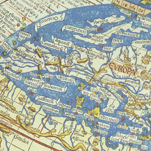
Ptolemy's World Map
Claudius Ptolemy lived in the city of Alexandria in Egypt from about 100 to 170 CE. At that time Egypt was a Roman province and Ptolemy may have been a Roman citizen.

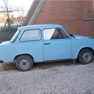
The Trabant
For many in the West the Trabant automobile was one of the symbols of the economic differences between Eastern and Western Europe.

Operation Babylift
These photographs were taken on April 5, 1975 on one of the Pan Am passenger planes that airlifted Vietnamese orphans and Amerasian children of American servicemen and Vietnamese women for Operation Babylift.