Asia
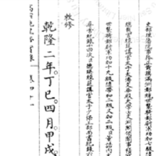
Short Teaching Module: Translation and a World History of the Qing Empire
In 1953, L. P. Hartley famously wrote: “The past is a foreign country: they do things differently there." His observation is particularly relevant for world historians, who have to engage in translation projects to bridge the distance between our world and the worlds of our historical actors.

Short Teaching Module: Global Microhistory and the Nineteenth-Century Omani Empire
In their primer essay, Jessica Hanser and Adam Clulow note how scholars of global microhistory explore relationships between macro and micro, deep structures and contingency, and big state actors and minor players.
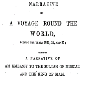
Memoir of William Ruschenberger
Dr. William Ruschenberger (d. 1895) was a United States Navy surgeon and was assigned to the USS Peacock, serving with Edmund Roberts as part of an American delegation representing the Jackson Administration to negotiate treaties with the Omani Empire and the Kingdom of Siam.

Short Teaching Module: Spatial Histories of Law, Race and Empire
Law is not only to be found in doctrine and documents, but also in structures and materials, in buildings and in cloth, in paintings and in photos.

The landraad in Pati
This is a photo of a mixed colonial law court, the landraad, in Pati, a town located on the island of Java, now part of Indonesia. The photo was made by the British photographers Woodbury & Page on the request of the bupati (regent) Raden Adipati Ario Tjondro Adhi Negoro.
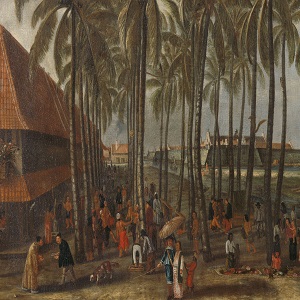
The Batavia Castle
Seventeenth-century market in the city Batavia (nowadays Jakarta, Indonesia), the central node of Dutch imperial activities in the Indian Ocean region. The Batavia Castle is visible in the background and to its right the Council of Justice with the gallows and whipping post in front of it.
Short Teaching Module: Examining Early Genoese Voyages through Maps
The medieval Genoese ranged from China to the Atlantic, and their experience in navigation, the sugar industry, and the slave trade were the elemental foundation of Iberian colonial expansion.
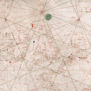
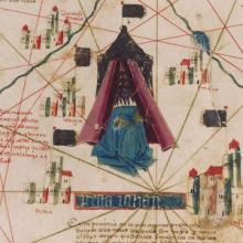
Nautical Chart, 1385
This nautical chart is signed by Majorcan cartographer Guglielmo Soler and dated to 1385, and ranges from the Black Sea to the Atlantic. Less beautiful than the Catalan map, it was also more practical for navigators to use.
Short Teaching Module: Making Empire Global - British Imperialism in India, 1750-1800
The study of world history has often overlapped with scholarship on empire and imperialism.
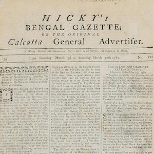
Hicky's Bengal Gazette
Hicky’s Bengal Gazette was the first printed newspaper to be published in India.