Browse Primary Sources
Locate primary sources, including images, objects, media, and texts. Annotations by scholars contextualize sources.
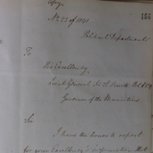
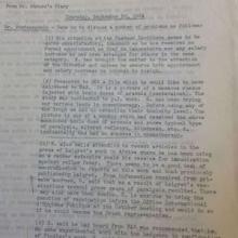
1841 Letter from Atkins Hamerton
Atkins Hamerton (d. 1857) was a British military officer and diplomat, who served as the first British Consul to the Omani Empire based in Zanzibar. He left behind thousands of pages of sources, presently scattered between archives in the U.K., Zanzibar, and India.
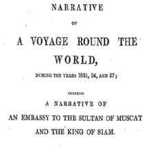
Memoir of William Ruschenberger
Dr. William Ruschenberger (d. 1895) was a United States Navy surgeon and was assigned to the USS Peacock, serving with Edmund Roberts as part of an American delegation representing the Jackson Administration to negotiate treaties with the Omani Empire and the Kingdom of Siam.
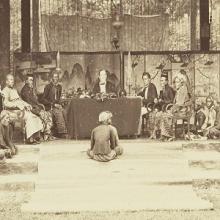
The landraad in Pati
This is a photo of a mixed colonial law court, the landraad, in Pati, a town located on the island of Java, now part of Indonesia. The photo was made by the British photographers Woodbury & Page on the request of the bupati (regent) Raden Adipati Ario Tjondro Adhi Negoro. We know the names of a few of the court members. Seated on the chair on the left side is the Chinese Captain Oei Hotam.
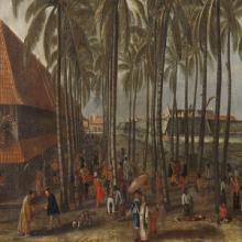
The Batavia Castle
Seventeenth-century market in the city Batavia (nowadays Jakarta, Indonesia), the central node of Dutch imperial activities in the Indian Ocean region. The Batavia Castle is visible in the background and to its right the Council of Justice with the gallows and whipping post in front of it. The Dutch artist depicts a varity of people at the market.
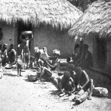
Togo farm families cracking oil palm kernels
This photo was part of a short photo series documenting palm oil production in the German colonies in Africa, included in a report by a special oil commission of the German Colonial Society (Deutsche Kolonialgesellschaft) in 1913.
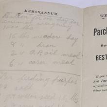
Ideal ration recipe
This is one page out of a notebook kept by Stephen Robinson Parsons, a somewhat improvement-minded farmer in South Paris, Maine. Around 1896, Stephen copied into his fact book an ideal ration:
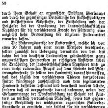
Wolff’s justification for omitting hay values
In 1864, for the first time, Emil Wolff did not include hay values alongside nutritional components in the data tables published annually in the calendar. In this accompanying article, Wolff reframed his previous translation into hay values as merely educational.
Mikhail Gorbachev’s Resignation Speech
This is a transcript of Gorbachev’s resignation speech. This speech signified the complete end of the Soviet Union. According to the speech, what reasons does Gorbachev give for his resignation? What is the overall tone of this document? Why do you think Gorbachev uses this tone?
The Alma-Ata Declaration
This document is a translation of the Belovezh Accords, the agreement which essentially declared that the Soviet Union ceased to exist. Those who signed it agreed to form a Commonwealth of Independent States (CIS). Which states were signatories of the Belovezh Accords? Were these all of the former Soviet republics or not? Which states did not sign?
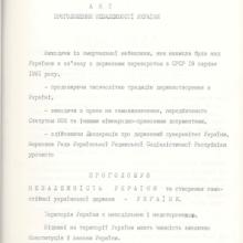
Act of Declaration of Independence of Ukraine
This source is one example of a former Soviet republic declaring its independence from the Soviet Union. Who created this document? What reasons does the document creator give for wanting to secede from the Soviet Union? What does this document suggest and what is the most telling language in this document that supports its main claims?
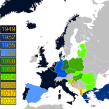
History of NATO Expansion Map
This map shows the expansion of NATO over time. Have students identify the most recently states to join NATO. Which states have joined NATO after the collapse of communism? Which of these newer NATO states had been Soviet satellite states as opposed to full republics of the Soviet Union? Which countries of interest do these newer members of NATO border?

Cold War Europe Military Alliances Map
This map illustrates which states in Europe belonged to NATO or the Warsaw Pact military alliance. The white states were neutral. This map illustrates the infamous Iron Curtain and the split between West and East. Which of these states belonged to the Warsaw Pact? For the states that belonged to the Warsaw Pact, were they satellite states or republics of the Soviet Union?
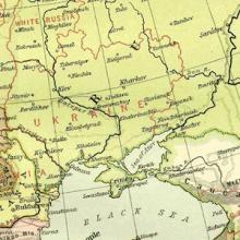
Map of Europe, 1918
This map illustrates European borders prior to the start of WWI in 1914 with black lines and new states formed by the First World War in red. As the map illustrates, a number of states became independent from Tsarist Russia. What new states were these? Do you think that newly found independence had an affect on nationalist movements in these areas?
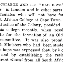
“The South African College and Its ‘Old Boys,’” 1886
The 1886 article, “The South African College and Its ‘Old Boys’,” provides an example of how universities extended their influence within an empire (or globally) through alumni and their expertise.
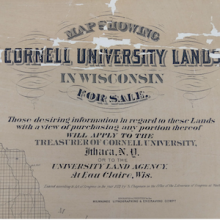
Map of Land Grant for Cornell University, 1877
Similar to the New Zealand land grant, yet within a distinct political context, the development of land-grant universities in the United States followed and encouraged an institutional financing model based upon Indigenous land acquisition, leasing, and sale.
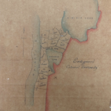
Map of Land Grant for New Zealand University, 1873
Depicting the North Island of Aotearoa New Zealand, this map outlines the lands that surround the Kimihia and Hakanoa Lakes in the Waikato Region. Small plots of land, 50 acres each, are demarcated and assigned to various landholders. Running parallel to these plots is the Waikato River, the map’s westernmost feature.
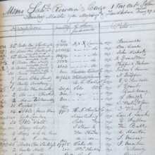
Outward Cargo Manifest of the Rowena, 1841
Cargo manifests and other shipping records offer a tangible glimpse into expansive commercial networks, reminding observers of the physical goods underwriting long distance trade. Amongst other merchandise, the Rowena carried hundreds of thousands of yards of cotton cloth—shirtings, sheetings, and drills—which served as the basis of American trade in the Western Indian Ocean.
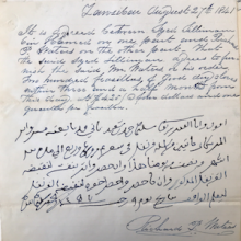
American and Zanzibari Trade Contract, 1841
This contract, one of few bilingual agreements that survive, illustrates the practical commercial system that Indian, Arab, and American traders developed on Zanzibar. The document outlines the quantity, quality, and price of the cloves being sold as well as their expected delivery date.
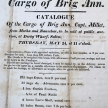
Advertisement for the Auction of the Ann’s Cargo, 1827
This flyer advertises the Ann’s 1827 arrival in Salem, Massachusetts, after making one of the first American trips to Zanzibar. The Ann’s cargo included goods that were likely procured on the island, such as ivory and gum copal, alongside wares from the Arabian Peninsula like coffee, dates, frankincense, and myrrh.
Rockefeller Foundation Report Concerning the Yellow Fever Vaccine
The creation of the yellow fever vaccine turned out to be quite controversial. Many of these controversies are revealed in documents such as this summary of correspondence between Georges Stefanopoulo, a Pastorian microbiologist, and his colleagues at the Rockefeller Foundation in New York.