Europe
"Yellow fever in Dakar – There is no epidemic"
This is an excerpt from an interview with Blaise Diagne, the Senegalese deputy to the National Assembly, published in Le Matin, one of the major national dailies in metropolitan France.
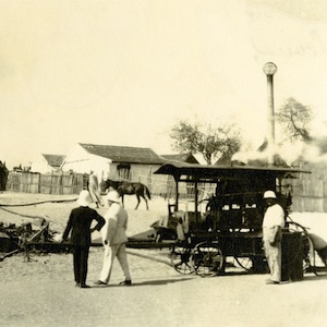
Disinfection of Dakar houses with a Clayton Apparatus
This is a photograph from the collections of the Rockefeller Archive Center depicting a Clayton apparatus disinfecting African houses during the yellow fever outbreak of 1927. The image illustrates a number of transnational linkages that shaped the epidemic.

Original Manuscripts of Anne Frank
Born to a Jewish family in 1929, Anne Frank is most known for the diary she kept while in hiding from Nazi forces during World War II. The War broke out in 1939 when Anne was ten-years-old.

Short Teaching Module: Global Approaches to Maritime Trade in Colonial North America
Traditional narratives in American history, especially in colonial history, tend to focus primarily on British policy and British trade networks. Taking a global approach to the maritime trade of British America in the colonial era provides a better understanding of the actual economy, however.

Bill of Lading of a ship from Piscataqua to Bilbao in Spain, 1721
This bill of lading is a standard form used in shipping in the 18th century.
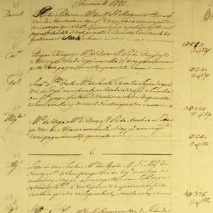
Lisbon Port Entry List for Colonial American Ships, 1771
This is just one example of thousands of pages and documents that the Portuguese use to manage and record the trade coming in and out of their ports.
Short Teaching Module: Examining Early Genoese Voyages through Maps
The medieval Genoese ranged from China to the Atlantic, and their experience in navigation, the sugar industry, and the slave trade were the elemental foundation of Iberian colonial expansion.
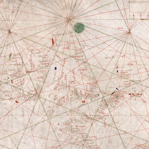
Nautical Chart, 1385
This nautical chart is signed by Majorcan cartographer Guglielmo Soler and dated to 1385, and ranges from the Black Sea to the Atlantic. Less beautiful than the Catalan map, it was also more practical for navigators to use.
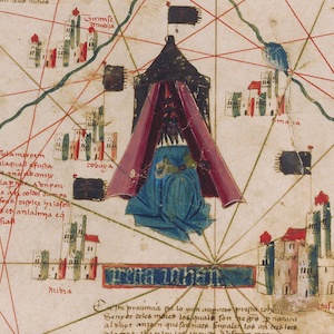
Catalan Map of the World, c.1450
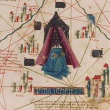
Dated to the mid-fifteenth century, this Catalan world map is over a meter in diameter on a sheet of vellum (high-quality parchment made of calfskin). Unlike many other surviving charts, this was not meant for practical navigation, though it was based on such nautical charts.
Short Teaching Module: Making Empire Global - British Imperialism in India, 1750-1800
The study of world history has often overlapped with scholarship on empire and imperialism.