Early Modern (1450 CE - 1800 CE)

Map of the Treaty of Fort Stanwix, 1768
In 1768, Sir William Johnson received permission from the British Crown to hold a treaty council with the Iroquois Confederacy and its dependents in order to establish a more official and lasting boundary line without French pressures.
Excerpts from the Treaty of Logg's Town (1752)
As French and British powers jostled for dominance in the Ohio Country, both courted the Six Nations and their allies. The Six Nations held sway and power over mass amounts of territory—territory that French and British interests wished to control.

Short Teaching Module: Using Ships as Guides for Transnational Adventures through World History
Ships travel across oceans and in doing so connect people in disparate places across the globe. In this essay, Brandon Tachco explains how a focus on ships as a theme can add much to the study of world history.

Chinese Junk, early 18th century
Junks encompass a range of different ships that were essential for maritime trade in East Asia, Southeast Asia, and the Indian Ocean for centuries. Original junks built in China were likely inspired by the design of ships visiting Chinese ports from Austronesia and Southeast Asian archipelagos.

A Naval Encounter between Dutch and Spanish Warships
Spanish galleons were large ships specifically built to carry a huge amount of cargo across the vast distances of the Spanish maritime empire. The Manila Galleon Trade is a common topic in world history courses and represents the first truly global trade in world history.

Short Teaching Module: Premodern Chinese Maps and the Global Maritime World
Premodern Chinese maps offer fascinating sources for teachers and students of world history.

Selden Map
The Selden Map held by the Bodleian Library in Oxford, where it has been kept since 1659. This beautifully illustrated manuscript map shows East and Southeast Asia and marks maritime trading routes in the form of lines across the region.
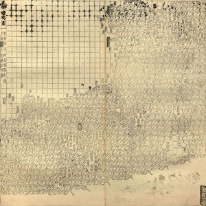
Guang yutu map
The map of the “South-Eastern ocean barbarians” from the 1558 edition of the atlas Guang yutu. This atlas is divided into two parts, the first one deals with the geography of China, the second one with the Chinese borderlands, thematic maps, and maps of non-Chinese regions.
Excerpts from the Treaty of Fort Stanwix (1768)
After decades of skirmishing and cold-war jostling, tensions between Great Britain and France all across the globe finally came to a head in the Seven Years’ War (1756-1763).
Excerpts from the Treaty of Lancaster (1744)
With the threat of war with France looming on the horizon, the English colonies treated with the Iroquois Confederacy to determine a clearer boundary line between Indian lands and the western edges of the English colonies in pursuit of peace.