Post-Classical (500 CE - 1450 CE)
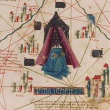
Short Teaching Module: Examining Early Genoese Voyages through Maps
The medieval Genoese ranged from China to the Atlantic, and their experience in navigation, the sugar industry, and the slave trade were the elemental foundation of Iberian colonial expansion.
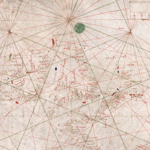
Nautical Chart, 1385
This nautical chart is signed by Majorcan cartographer Guglielmo Soler and dated to 1385, and ranges from the Black Sea to the Atlantic. Less beautiful than the Catalan map, it was also more practical for navigators to use.
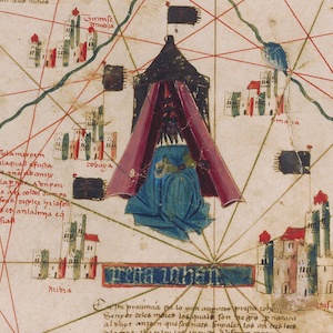
Catalan Map of the World, c.1450
Dated to the mid-fifteenth century, this Catalan world map is over a meter in diameter on a sheet of vellum (high-quality parchment made of calfskin). Unlike many other surviving charts, this was not meant for practical navigation, though it was based on such nautical charts.
Short Teaching Module: Maya Writing
In the period from 200 to 900 C.E, which scholars later labelled the Classic Period, the Maya developed the most complex writing system in the Americas, a script with nearly a thousand characters (termed “glyphs”) that represent concepts and sounds, which over the last fifty years has been largel
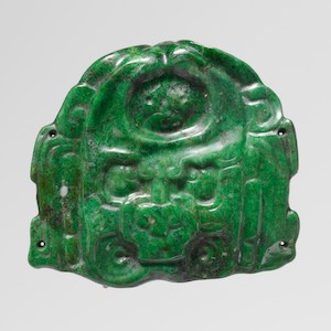
Maya Deity-Face Jade Pendant, 7th-8th century
This small carved jade ornament, about 2 inches square, was most likely the central ornament on the paper headband of a Maya ruler.
Maya Drinking Vessel with Seated Lord, 7th-8th century
This large ceramic vessel, made for drinking chocolate, shows a figure wearing a loincloth, necklace, and a large headdress that looks like the tail feathers of the quetzal bird.

Maya Vase with Mythological Scene, 7th-8th century
This drinking cup shows the aging Rain God Chank with a ceremonial ax in one hand and the other on a building that has split open.

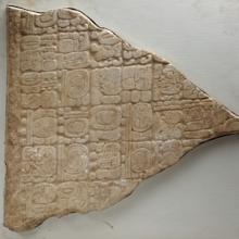
Maya Monument with glyphs, 4th-9th centuries
This stone monument carved with glyphs comes from Tortuguero, a Maya archeological site in southernmost Tabasco, Mexico that has been badly damaged by development. The monument is in a museum in Tabasco, and the smaller fragment is in the Metropolitan Museum in New York City.
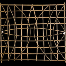
Short Teaching Module: History of the Pacific Ocean
Scholars of Pacific history explore how people build lives dependent on the ocean, how maritime connections create communities, and how humans and the environment shape each other.
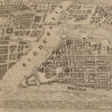
Primer: Global Urban History
Urban history is a rich subfield of historical scholarship that examines life in urban spaces, how communities within cities interact and coexist, as well as the process of city formation and urbanization.