Modern (1800 CE - 1950 CE)
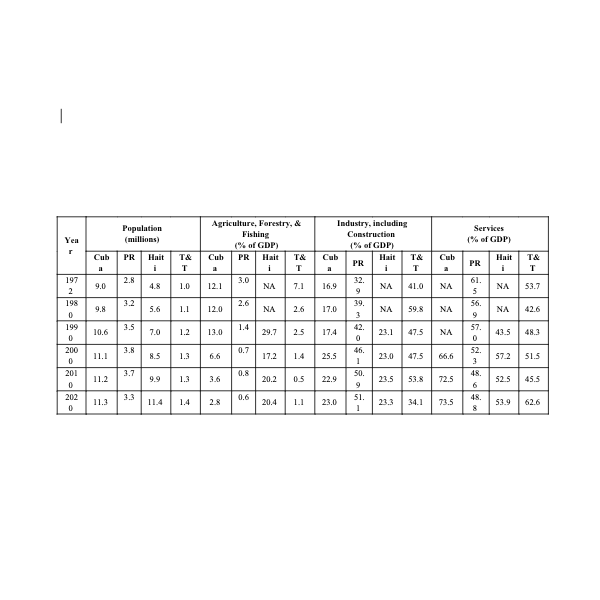
Popular World Development Indicators for Four Caribbean Countries
Raw numerical data may be pursued to track historical behavior through socioeconomic and demographic indicators.
Short Teaching Module: Science, Technology, and the U.S. Military-Industrial Complex during the Cold War
For decades, the relationship between science and the U.S. government during the early Cold War years was understood largely as a story of a militaristic state persecuting and co-opting scientists and scientific institutions to serve national security interests.

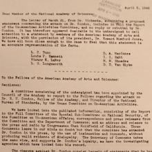
National Academy of Sciences objects to political persecution of Condon, 1948
This document from 1948 expresses concern by members of the National Academy of Sciences (NAS) over the political persecution of Edward Condon, a physicist and director of the Bureau of Standards.

AAAS Defends Edward Condon from HUAC, 1948
This document from 1948 circulates to members of the American Academy of Arts and Sciences (AAAS) the organization’s position on the political persecution of Edward Condon, a physicist and director of the Bureau of Standards.
Short Teaching Module: Borderland Migration and Communities in Twentieth-Century West Africa
Cross-border mobility has created borderland cultures and led to the development of vibrant communities that in some cases have stretched across several states.
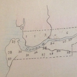
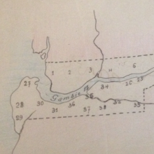
Map and Population Table for British Gambia, 1915-1918
Many people in West Africa fled across colonial boundaries to avoid military conscription in the late 19th and early 20th century. For example, during World War I, tens of thousands of people left the French colony of Senegal for neighboring British Gambia and Portuguese Guinea-Bissau.

Short Teaching Module: Building Materials as an Indicator of Transnational Encounters in Malaysia
Building materials are an important component of construction. The characteristics of each material determine the properties of a structure that can be built.
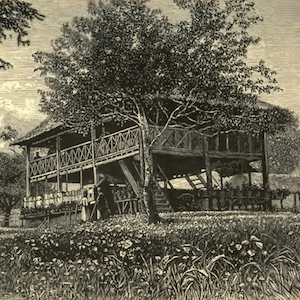
British Police Station, Rasah, Malaysia
Many of the earliest British buildings in the Malay Peninsular were inspired by contemporary Malay structures. Most of these buildings do not exist anymore because they were built to serve temporary functions and were eventually replaced by permanent structures once masonry became available.
Short Teaching Module: Portraying Women Workers: Beyond Norma Rae
Starting at the turn of the twentieth century, U.S. and insular government offices and textile and garment businesses incorporated women of the New South and Puerto Rico into manufacturing in distinct yet interrelated ways.

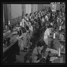
Puerto Rican Needleworkers in a Factory, San Juan, Puerto Rico, 1942
This government photograph provides an important contrast to the popular culture images of poor southern whites. During the 1940s and 1950s, U.S. government agencies hired photographers to travel the main island of Puerto Rico to capture the conditions of working people.