Global Contact
New York Times editorial on Mexico, November 21, 1855
The New York Times was founded in 1851. It was an antislavery newspaper before the Civil War, helping to establish the Republican Party in 1854. It covered international as well as national and local affairs. Historians regard the Times as a gauge of American opinion at the time.

Remains of Christopher Colombus
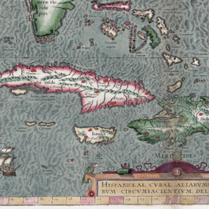
In October of 1492, the Spanish monarchs sponsored a voyage led by Columbus and his crew, who intended to sail towards India. Instead, they set foot in the Americas for the first time. Over the next several years, Columbus made many trips back and forth between Spain and the Caribbean Islands.

Digital Library of the Caribbean
Educators, students, and scholars interested in understanding the strategic conflicts between European powers, the experience of Africans during the transatlantic slave trade, the emergence of the modern capitalist system, and the rise of neoliberalism would find in dLOC a wealth of content to draw
Consolation Prize
Consolation Prize is a fantastic podcast that comes highly recommended for anyone who has an interest in American history, or even for those who just enjoy well-told, solidly researched stories.
Cecil Rhodes monument removal, Cape Town, South Africa
The bronze statue of a seated Cecil Rhodes (1853-1902), on the campus of the University of Cape Town (UCT), was sculpted by Marion Walgate, one of the first white female sculptors in South Africa.

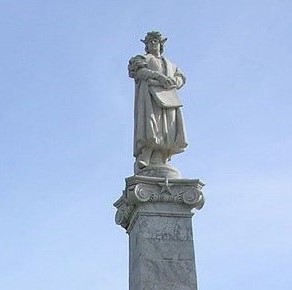
Christopher Columbus monument removal, Buenos Aires, Argentina
The Monument to Christopher Columbus (1451?-1506), located in a plaza in front of the Casa Rosada government palace, was inaugurated in 1921.

Christopher Columbus monument, Buenos Aires, Argentina
The Monument to Christopher Columbus (1451?-1506), located in a plaza in front of the Casa Rosada government palace, was inaugurated in 1921.

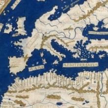
Short Teaching Module: European Maps of the Early Modern World
I use images of three historical maps for topics on colonial exploration and for interpreting historical evidence in undergraduate courses on history and historical methodology. I have several aims in using the maps.

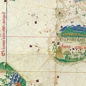
Cantino planisphere
The famous Cantino planisphere was made in 1502 by an anonymous Portuguese official at the request of Alberto Cantino, an Italian agent in Lisbon of Ercole d’Este, Duke of Ferrara.

World map by Henricus Martellus
Henricus Martellus was a German geographer and cartographer who worked in the Italian city of Florence from 1480 to 1496. His book of 1490, Insularium Illustratum ("Illustrated Book of Islands"), in which this map appeared, was widely circulated for two reasons.