Trade
Multiplication with an Early Modern Counting Board
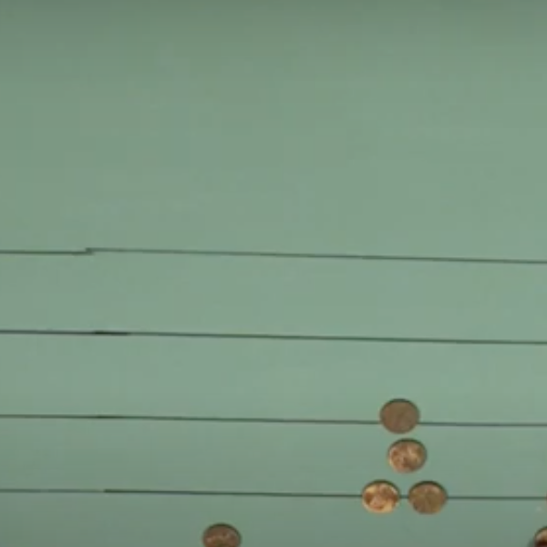
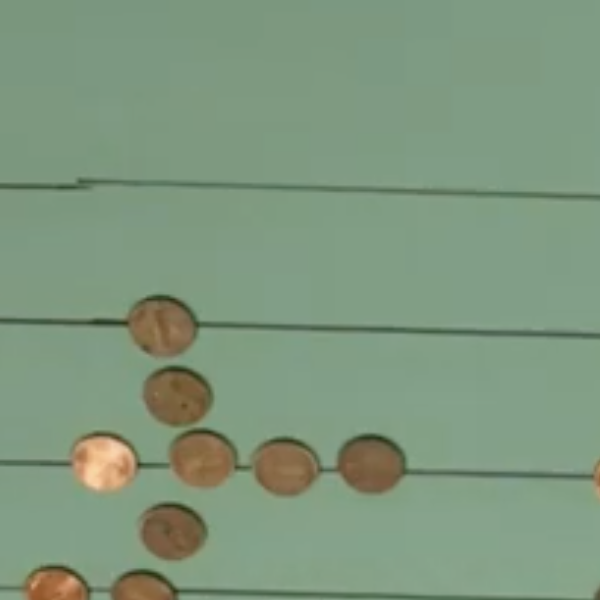
Before the rise of literacy rates, counting boards such as the one featured in the video were the most common way to perform arithmetic. After pen-and-paper arithmetic replaced counting boards, Arabic numerals also became dominant throughout Europe.
Engraving of a Rechentisch (Counting Board)
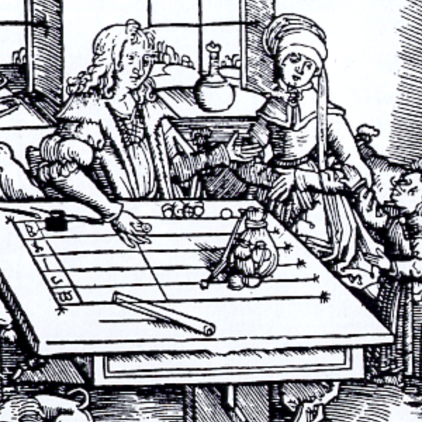
This image of an engraving depicts a man using a rechentisch, or counting board, the earliest known counting device and a precursor the abacus. The earliest known counting board is the Salamis Tablet, dating from 300 BCE, but may have been used more for gaming than for calculating.
Moche Portrait Vessels
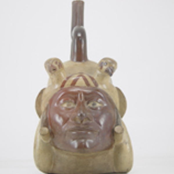
Moche portrait vessels are ceramic vessels that often featured only heads, but some also have full human bodies as well, and most are representations of adult men.

Shell Pendant or Bead from Ecuador
This pendant or bead was made from a shell and dates back to the 3rd millennium BCE. Found in Ecuador, it was likely made by the Valdivia culture, a people who lived on the western coast and mainly subsisted off fishing and farming and flourished between the years of 3500 BCE - 1500 BCE.

Lapita Pottery from the Santa Cruz Islands
This pottery sherd dates from around 1000 BCE and is from the Lapita culture, the likely common ancestor of contemporary Polynesian cultures. This sherd was found in the Santa Cruz Islands, part of the Solomon Islands.

History of Pre-Modern Math
Before the widespread adoption of Arabic numerals, medieval and early modern Europeans added, subtracted, multiplied, and divided using a type of abacus known as a counting board and only afterwards recorded the results of their ca
Adding and Subtracting with an Early Modern Counting Board
Before the rise of literacy rates, counting boards such as the one featured in the video were the most common way to perform arithmetic. After pen-and-paper arithmetic replaced counting boards, Arabic numerals also became dominant throughout Europe.

Long Teaching Module: Caribbean Seafaring in the Archaic Age (2000-400 BC)
There have been many different approaches to studying seafaring in the past. We can look at the evidence of voyages in books written by prominent explorers or follow the maps maintained by successful prominent trading companies.
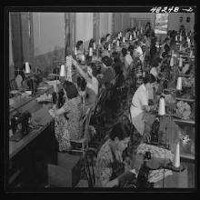
Short Teaching Module: Portraying Women Workers: Beyond Norma Rae
Starting at the turn of the twentieth century, U.S. and insular government offices and textile and garment businesses incorporated women of the New South and Puerto Rico into manufacturing in distinct yet interrelated ways.

Brochure for the South Carolina Inter-State and West Indian Exposition / Charleston Exposition, 1901-1902
This is the cover for a pamphlet to promote the Charleston Exposition and recruit exhibitors and attendees from along the entire U.S. Atlantic, which ran from New England to Florida to Cuba and Puerto Rico.