Middle East
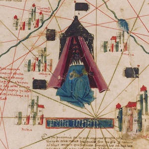
Nautical Chart, 1385
This nautical chart is signed by Majorcan cartographer Guglielmo Soler and dated to 1385, and ranges from the Black Sea to the Atlantic. Less beautiful than the Catalan map, it was also more practical for navigators to use.
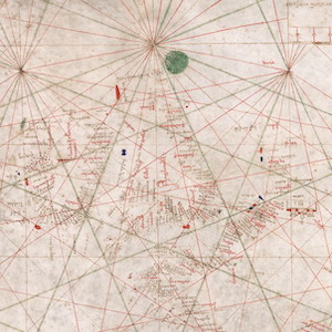
Catalan Map of the World, c.1450
Dated to the mid-fifteenth century, this Catalan world map is over a meter in diameter on a sheet of vellum (high-quality parchment made of calfskin). Unlike many other surviving charts, this was not meant for practical navigation, though it was based on such nautical charts.

Photograph from an Independence Protest, Alexandria, Egypt, 1919
Following the close of World War I, Egypt became a hotbed of anti-colonial nationalism. Leaders of the nationalist Wafd party formally demanded Egyptian independence to British and US officials, utilizing many of U.S. President Woodrow Wilson’s own phrases and rhetoric in their appeals.
Excerpts from Harem Years: Memoirs of an Egyptian Feminist, 1879-1924
The peace process that followed World War One catalyzed calls for self-determination around the colonized world. Existing nationalist organizations seized on the liberal pretensions of the Entente Powers to articulate social and political demands to colonial powers.
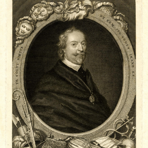
Frontispiece of Sir Thomas Roe
This image is the frontispiece of Sir Thomas Roe (ca. 1581-1644) from the book The Negotiations of Sir T. Roe in his Embassy to the Ottoman Porte from the year 1621 to 1628, a collection of his correspondence during his time as the English ambassador to the Ottoman Empire.
Persian Language Rare Materials
The Persian Language Rare Materials Collection is an online repository of manuscripts, printed books, lithographs, and imprints which have a variety of purposes, including discussing scientific, religious, philosophical and literary topics.
Diotíma
Diotima holds materials related to teaching Ancient Mediterranean Studies from a feminist perspective, including bibliographies, open access images, as well as syllabi.
Eltaher Collection
This collection is a good resource for learning about the fight for decolonization in the Middle East and Northern Africa, from the perspective of those being colonized.
American Colony in Jerusalem, 1870 to 2006
In a classroom setting, it might be used to study religion, as well as the history of Jerusalem more specifically.