Oceania

Map of Land Grant for Cornell University, 1877
Similar to the New Zealand land grant, yet within a distinct political context, the development of land-grant universities in the United States followed and encouraged an institutional financing model based u

Map of Land Grant for New Zealand University, 1873
Depicting the North Island of Aotearoa New Zealand, this map outlines the lands that surround the Kimihia and Hakanoa Lakes in the Waikato Region. Small plots of land, 50 acres each, are demarcated and assigned to various landholders.

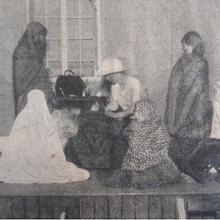
Sewing Classes at Mount Margaret Mission
These two photographs, from the State Library of Western Australia, show Aboriginal girls learning to sew from Dorothy Lovick at the Mount Margaret Mission in Laverton, Australia, in the 1930s. The first photograph shows a middle school class, while the second one features a senior class.

“Maori Girls School”
This article, which was published in the newspaper Manawatu Times on April 14, 1905, announces the opening of a school for Māori girls.

Long Teaching Module: Exploring Empire through the Lens of Childhood and Gender
As European empires expanded at the end of the end of the nineteenth century, imperialism came to permeate everyday life and had a pervasive influence on childhood, shaping everything from education to sports and literature.

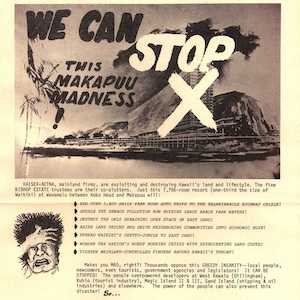
"We can stop this Makapuu madness!"
After World War II, the rise of jet travel and mass tourism brought new visitors—and new pressures—to many places within the Pacific Ocean. Hawaiʻi is a prime example of how tourism-driven development and activist responses have shaped local environments.

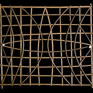
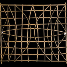
Marshall Islands stick chart
Across millennia, Pacific people voyaged out to sea and settled the ocean’s thousands islands and atolls, linking new discoveries back to existing territories.

Short Teaching Module: History of the Pacific Ocean
Scholars of Pacific history explore how people build lives dependent on the ocean, how maritime connections create communities, and how humans and the environment shape each other.

World History for Us All
Its units and lesson plans utilize a range of primary sources, which revolve around three themes are: Humans and the Environment, Humans and Other Humans, Humans and Ideas.