Browse Primary Sources
Locate primary sources, including images, objects, media, and texts. Annotations by scholars contextualize sources.
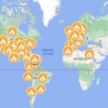
Map with Many of the Protests in Puerto Rico and the World 2019
An event in Puerto Rico that captured world attention and motivated the interest of many Puerto Ricans in the diaspora to participate was the Summer of 2019 movement. In this event, at least a third of the population of Puerto Rico took to the streets to demand political and economic change.
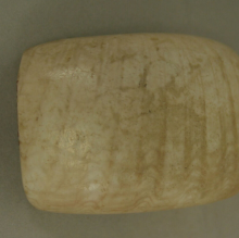
Shell Pendant or Bead from Ecuador
This pendant or bead was made from a shell and dates back to the 3rd millennium BCE. Found in Ecuador, it was likely made by the Valdivia culture, a people who lived on the western coast and mainly subsisted off fishing and farming and flourished between the years of 3500 BCE - 1500 BCE.
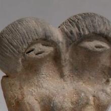
Ceramic Female Figure from Ecuador
This clay figure dates from the third millennium BCE and is evidence of the earliest known ceramic traditions of any ancient peoples in the Americas. This figure, and many others like it, are from the Valdivia culture of Ecuador. The Valdivia produced many stylized representations of human figures that often lack a clear face and were usually female.
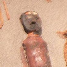
Chinchorro Mummies
The Chinchorro mummies, named for the Chinchorro people of current-day Chile and Peru, are the world’s oldest known examples of intentional mummification. predating Egyptian examples by almost 2,000 years. Hundreds of mummies were discovered and radiocarbon dating placed their age around 7,000 years old.
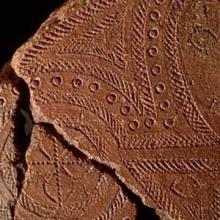
Lapita Pottery from the Santa Cruz Islands
This pottery sherd dates from around 1000 BCE and is from the Lapita culture, the likely common ancestor of contemporary Polynesian cultures. This sherd was found in the Santa Cruz Islands, part of the Solomon Islands.
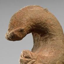
Zoomorphic Figure from Papua New Guinea
This stone figure from an unknown culture in ancient Oceania may represent an echidna, which is an egg-laying mammal that is related to the platypus. Stone figures from this region were often shaped to represent animals or human heads and could be used as mortars, pestles, club heads, or simply for rituals.
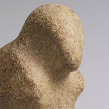
Bird Stone Figure from Papua New Guinea
This stone figure from ancient Oceania loosely shaped like a bird comes from an unknown ancient culture that lived in the highlands of Papua New Guinea.
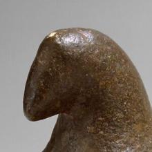
Pestle Finial from Papua New Guinea
This image is of a pestle finial in the shape of a bird from an unknown culture in ancient Oceania. Pestles are a tool used for crushing or grinding, often used for cooking ingredients such as spices, and were likely also used with other stone mortars that have been found in the region.
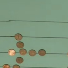
Adding and Subtracting with an Early Modern Counting Board
Before the rise of literacy rates, counting boards such as the one featured in the video were the most common way to perform arithmetic. After pen-and-paper arithmetic replaced counting boards, Arabic numerals also became dominant throughout Europe.

One Voice SOMOS Live! A Concert for Disaster Relief
Several Caribbean public figures (Puerto Rican artists Jennifer López and Marc Anthony and baseball player Alex Rodríguez) served as ambassadors of the Greater Caribbean before the world, to raise funds to address the immediate needs of the 2017 disaster victims in Puerto Rico and many other parts of the regions around th
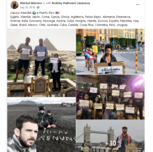
Solidarity Expressions from the Puerto Rican Diaspora
An event in Puerto Rico that captured world attention and motivated the interest of many Puerto Ricans in the diaspora to participate was the Summer of 2019 movement. In this event, at least a third of the population of Puerto Rico took to the streets to demand political and economic change.
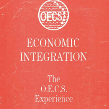
OECS Treaty Publication Fragments
The OECS published in 1988 a booklet explaining the treaty that founded it (OECS 1988). A fragment is included in the photos here. This piece of the document focuses on explaining the integration provisions of the treaty, including the common market.
Transcript of the Treaty of Basseterre of 1981
To capture the diplomatic side of Caribbean economic history from the point of view of the governments, official documents describing economic policies, joint strategies, and related decision-making processes in the Caribbean region could be pursued.
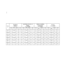
Popular World Development Indicators for Four Caribbean Countries
Raw numerical data may be pursued to track historical behavior through socioeconomic and demographic indicators. This data might be the basis to identify and understand socioeconomic challenges and potential solutions that should be addressed through economic diplomacy.
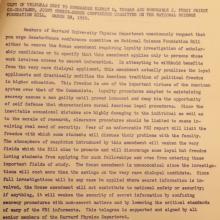
Harvard Physics Department asserts that investigations threaten national security, 1950
This document is the response of the Harvard University Physics Department to a proposed Congressional amendment in 1950 requiring that the FBI investigate scientists’ “loyalty” before they could receive government contracts. As the Harvard scientists write, heavy-handed attempts to root out the very rare disloyal applicant would be highly damaging overall to the morale of researchers.
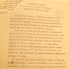
National Academy of Sciences objects to political persecution of Condon, 1948
This document from 1948 expresses concern by members of the National Academy of Sciences (NAS) over the political persecution of Edward Condon, a physicist and director of the Bureau of Standards. Dating back to the 1860s, the NAS is a professional association tasked with giving scientific advice to the government.
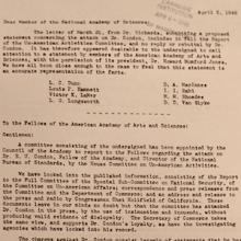
AAAS Defends Edward Condon from HUAC, 1948
This document from 1948 circulates to members of the American Academy of Arts and Sciences (AAAS) the organization’s position on the political persecution of Edward Condon, a physicist and director of the Bureau of Standards. Condon was a moderate internationalist who had a then-mainstream view that atomic bombs were too dangerous for any one country to control.
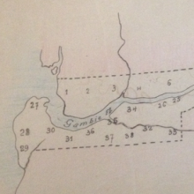
Map and Population Table for British Gambia, 1915-1918
Many people in West Africa fled across colonial boundaries to avoid military conscription in the late 19th and early 20th century. For example, during World War I, tens of thousands of people left the French colony of Senegal for neighboring British Gambia and Portuguese Guinea-Bissau.
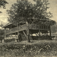
British Police Station, Rasah, Malaysia
Many of the earliest British buildings in the Malay Peninsular were inspired by contemporary Malay structures. Most of these buildings do not exist anymore because they were built to serve temporary functions and were eventually replaced by permanent structures once masonry became available.

Wooden Stockade on Penang Island, 18th century
This stockade was painted by Captain Elisha Trapaud in 1787 and the painting is preserved in the India Office Library in London. Construction of the fort started in August 1786 as soon as Francis Light had taken possession of Penang Island (part of present day Malaysia) away from the Kedah Sultanate.