Geography

The Atlantic Slave Trade and Slave Life in the Americas: A Visual Record
The images document the history of enslavement in West and West Central Africa, the English and French Caribbean, Brazil, and the United States.
Caribbean Views
The online collection is of extraordinary quality, both in terms of the scanned images and the contextual detail provided.
Great Unsolved Mysteries in Canadian History
Students may begin by focusing on 'solving' the crime itself, but along the way will be drawn into the consideration of wider issues
Al-Idrisi's World Map
The Nuzhat al-mushtāq fī ikhtirāq al-āfāq, most commonly known in the West as the Tabula Rogeriana ("The Book of Roger" in Latin), is a manuscript created by the Arab geographer Muhammad al-Idrisi that contains a highly detailed, partial-world map and extensive descriptions of the s

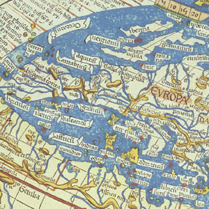
Ptolemy's World Map
Claudius Ptolemy lived in the city of Alexandria in Egypt from about 100 to 170 CE. At that time Egypt was a Roman province and Ptolemy may have been a Roman citizen.

Departments of 1798
Map of 1798 France depicting the Departments and major urban centers.
This source is a part of the The Napoleonic Experience teaching module.

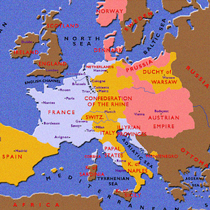
Map of Europe in 1812
A map of Europe in 1812 depicting French territory, French dependencies, and territories allied to Napoleonic France.
This source is a part of the The Napoleonic Experience teaching module.

Map of Europe in 1815
A map of Europe in 1815 depicting Napoleonic France, Prussia, the Austrian Empire, and the boundary of the Germanic Confederation.

Napoleon in Italy 1796-97
Map depicting Napoleon's campaigns in Italy, 1796-97.
This source is a part of the The Napoleonic Experience teaching module.

Napoleon’s Egyptian Campaign
Map depicting Napoleon's Egyptian campaigns.
This source is a part of the The Napoleonic Experience teaching module.