Military

Short Teaching Module: Connecting the French Empire
For a long time, historians tended to study colonial empires of the 19th and 20th centuries one colony at a time, or through the relationship of one colony to its metropole.

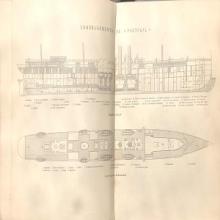
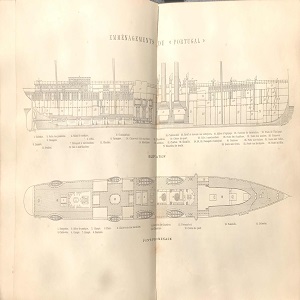
Ship Plan of a Late-19th Century Steamship
This ship plan from the late-19th century offers a partial view of spatial arrangements within a Messageries steamship.

Quilted bedcover of Elisabeth Chapman
This quilted bed cover was likely made for the marriage of John and Elisabeth Chapman on September 19, 1829.
Mandate for Palestine
The Mandate for Palestine was a legal document that established the United Kingdom as a Mandatory in charge of Palestine and Tran

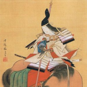
Tomoe Gozen
Tomoe Gozen was a Japanese female samurai that lived during the late twelfth century, or late Heian period, in Japan.

The Bayeux Tapestry
Most likely commissioned by Bishop Odo of Bayeux, the Bayeux Tapestry depicts William the Conqueror’s conquest of England, culmin

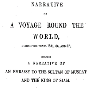
Memoir of William Ruschenberger
Dr. William Ruschenberger (d. 1895) was a United States Navy surgeon and was assigned to the USS Peacock, serving with Edmund Roberts as part of an American delegation representing the Jackson Administration to negotiate treaties with the Omani Empire and the Kingdom of Siam.

History of NATO Expansion Map
This map shows the expansion of NATO over time. Have students identify the most recently states to join NATO. Which states have joined NATO after the collapse of communism? Which of these newer NATO states had been Soviet satellite states as opposed to full republics of the Soviet Union?

Cold War Europe Military Alliances Map
This map illustrates which states in Europe belonged to NATO or the Warsaw Pact military alliance. The white states were neutral. This map illustrates the infamous Iron Curtain and the split between West and East. Which of these states belonged to the Warsaw Pact?

Map of Europe, 1918
This map illustrates European borders prior to the start of WWI in 1914 with black lines and new states formed by the First World War in red. As the map illustrates, a number of states became independent from Tsarist Russia. What new states were these?