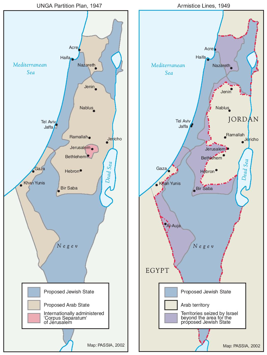
Map of the Partition of Israel and Palestine

Annotation
In 1947, Britain announced that it would terminate its mandate government in Palestine. As a result, a special committee formed by the United Nations was charged with partitioning the territory into separate, sovereign states. Although the plan called for Jewish and Arab states neatly divided by plotted lines, the reality, as these maps show, was much more contested. Movement, war, and armistice all served to continuously reshuffle the lines of the map as cartographers sought to impose some sense of order on the chaotic realm.
This source is a part of the Analyzing Maps methods module.
Credits
Israel Ministry of Foreign Affairs [https://mfa.gov.il/mfa/aboutisrael/maps/pages/1947%20un%20partition%20plan.aspx] and the Palestinian Academic Society for the Study of International Affairs [http://www.passia.org/maps/view/15].