History of NATO Expansion Map
Annotation
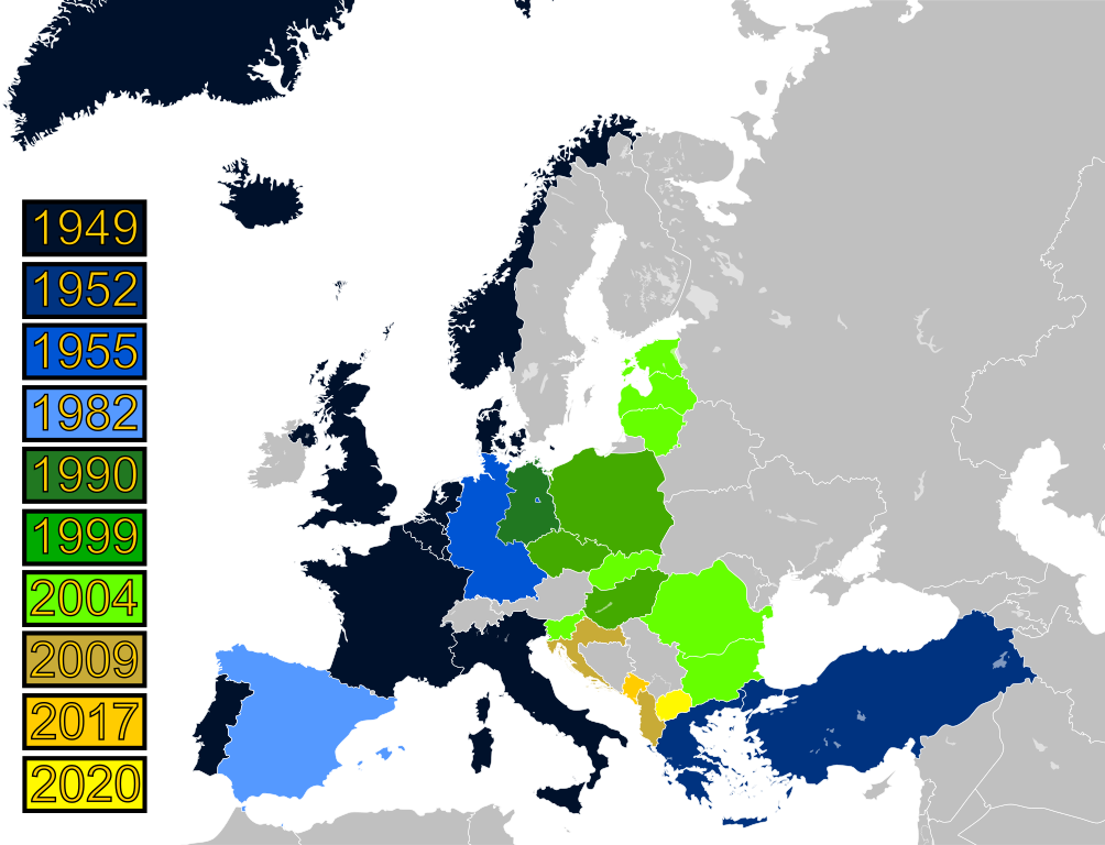
This map shows the expansion of NATO over time. Have students identify the most recently states to join NATO. Which states have joined NATO after the collapse of communism? Which of these newer NATO states had been Soviet satellite states as opposed to full republics of the Soviet Union? Which countries of interest do these newer members of NATO border? What are current relations like between the two types of former Warsaw Pact nations, those that joined NATO and those that have not? Is there any correlation between a breakdown of relations between nations over the transition from Warsaw Pact to NATO? Why might this be the case? Could those states that have not joined NATO be worried about neighbors joining their former foes? Do they feel threatened or that a foreign power in intervening in their sphere of influence? If so, why? What historical justifications might these nations have, perhaps related to the borders as shown the 1918 map of Europe?
This source is part of the teaching module on border changes of the Soviet Union.
Credits
From Wikimedia Commons, https://commons.wikimedia.org/wiki/File:History_of_NATO_enlargement.svg