Babylonian Map Tablet
Annotation
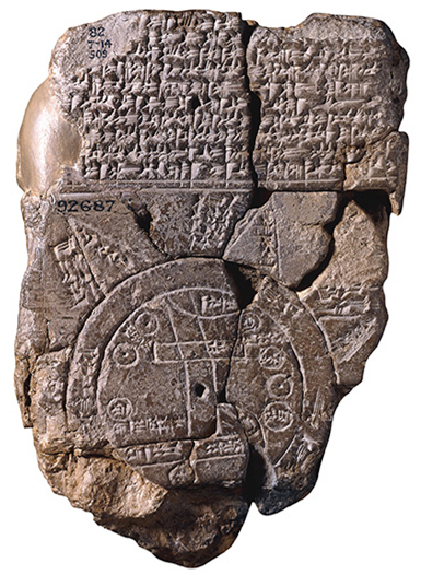
This ancient map depicts the known world as imagined by the Babylonians of the 6th century BCE. Like many ancient maps, this cuneiform tablet is concerned less with mathematically plotting space and direction than with simply capturing the various places and peoples in the world around Babylon. Here, Babylon represents the very center of the map and thus the world, situated along the banks of the Euphrates river. Encircling the flat, Babylonian world is a great ocean that marks the border between Mesopotamia and the mysterious lands beyond, represented here by six triangles.
This source is a part of the Analyzing Maps methods module.
Credits
Archaeological Institute of America [https://www.archaeology.org/issues/214-features/cuneiform/4365-cuneiform-maps].