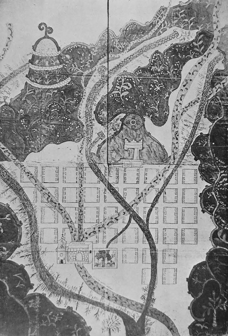
Pueblo of Texupa
Annotation
This is a copy of a relación geográfica. These relaciones were answers to a 1577 survey sent by King Philip II to his colonies, and each relación was composed of a map, usually drawn by an Indigenous artist, and a written text based on interviews often given by Indigenous informants to Spanish officials. In this map of the pueblo of Texúpa, located in present day Oaxaca, Mexico, there is evidence of both Indigenous and European styles. The footpaths for example show both human footprints and horse prints. Similarly the fortified hill on the upper left portion of the map illustrates a Spanish fortification whereas the decoration on the hilltop was a common addition by Indigenous artists.
Credits
Instituto Nacional de Antropología e Historia, Mexico City, Mexico. Annation by Joan Bristol, Associate Professor of History, George Mason University