Map of Poverty in Mexico
Annotation
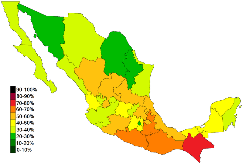
Maps are often designed to visualize more than just space and distance. This map, for instance, visualizes how poverty is distributed throughout the various Mexican states in hopes of identifying those areas most in need. The form of this map, or the artistic way in which the map is drawn, is meant to tell the story of how deeply the issue of poverty affects the people in each region. With the lighter colors symbolizing a lower rate of poverty and the darker colors extreme poverty, this map invites the viewer to begin to consider how and why poverty affects certain regions more than others. The focus on the distribution of poverty thus makes this a "thematic map," or a map that concerns itself with more than just geography and topography.
This source is a part of the Analyzing Maps methods module.
Credits
Wikipedia, 2012 [https://en.wikipedia.org/wiki/List_of_Mexican_states_by_poverty_rate].