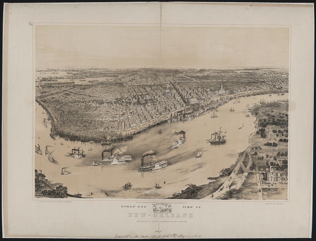
Birds-eye View of New Orleans

Annotation
Created by John Bachmann, this lithographic print provides a "bird's-eye" or aerial view of the bustling city of New Orleans, Louisiana in the mid-nineteenth century. A bird's-eye view is an elevated view of an object from the imagined perspective of a bird. Bird's-eye view maps, like this one of New Orleans, were extremely popular in the mid-to-late nineteenth century in the United States and Europe. The map depicts the New Orleans' waterfront along the Mississippi River. The multitude of paddle steamers traversing the river and lined up along the city's shoreline highlight the maritime importance of New Orleans as it sits just to the north of the mouth of the Mississippi River.
Credits
Bachmann, John, Artist. Birds' eye view of New-Orleans / drawn from nature on stone by J. Bachman i.e., Bachmann. New York, NY: Published by the agents A. Guerber & Co., ca. 1851, printed by J. Bachman. https://www.loc.gov/item/93500720/.
Annotated by Raymond Hyser