Nova Totius Terrarum Orbis Geographica Ac Hydrographica Tabula
Annotation
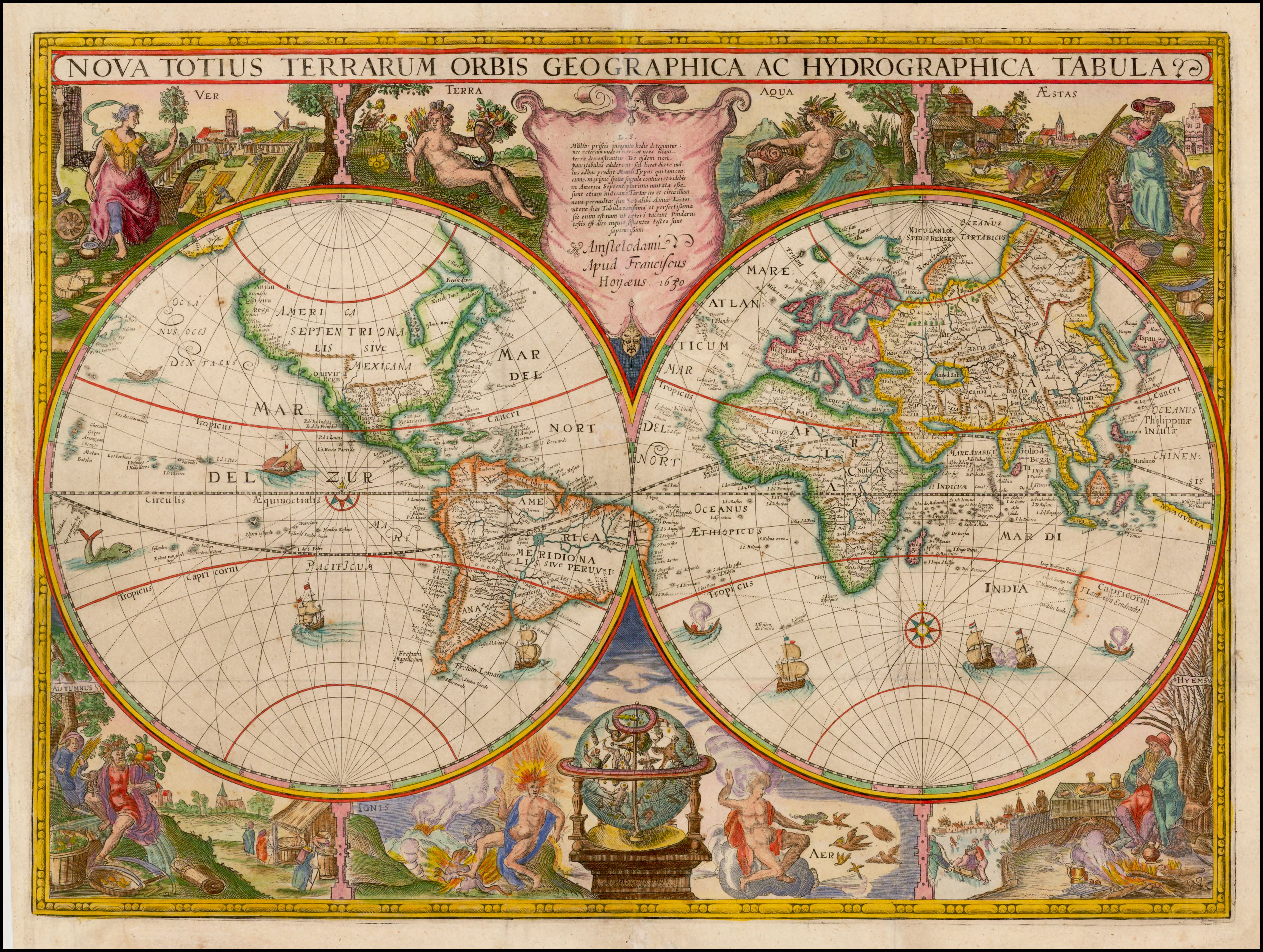
First issued by Jodocus Hondius in about 1625, this rare map of the world is the first printed map that depicts the Australian continent. The map shows the rough outline of the western coast of Australia in the bottom righthand corner. Dutch East India Company (VOC) captain Dirk Hartog encountered the west coast of Australia after his ship Eendracht was blown off course during its journey from the Netherlands to Indonesia in 1616. After Hartog and his crew made landfall in Australia's Shark's Bay area, the Eendracht sailed northward charting the continent's coastline. In honor of his voyage, Hartog named the land "T Landt van d'Eendracht" ("the Land of the Eendracht"). The map boasts allegorical figures depicting the four seasons in the corners and the four elements in the map's center. This 1630 version of the map is by Francis van der Hoeye (Franciscus Hoeius), a copper plate engraver and publisher active in Amsterdam between 1629-1636.
Credits
Barry Lawrence Ruderman Map Collection, Stanford University Libraries. "Nova Totius Terrarum Orbis Geographica Ac Hydrographica Tabula...1630." Accessed July 31, 2021. https://exhibits.stanford.edu/ruderman/catalog/nc157cg8390
Franciscus Hoeius, Nova Totius Terrarum Orbis Geographica Ac Hydrographic Tabula, ca. 1630
Annotated by Raymond Hyser