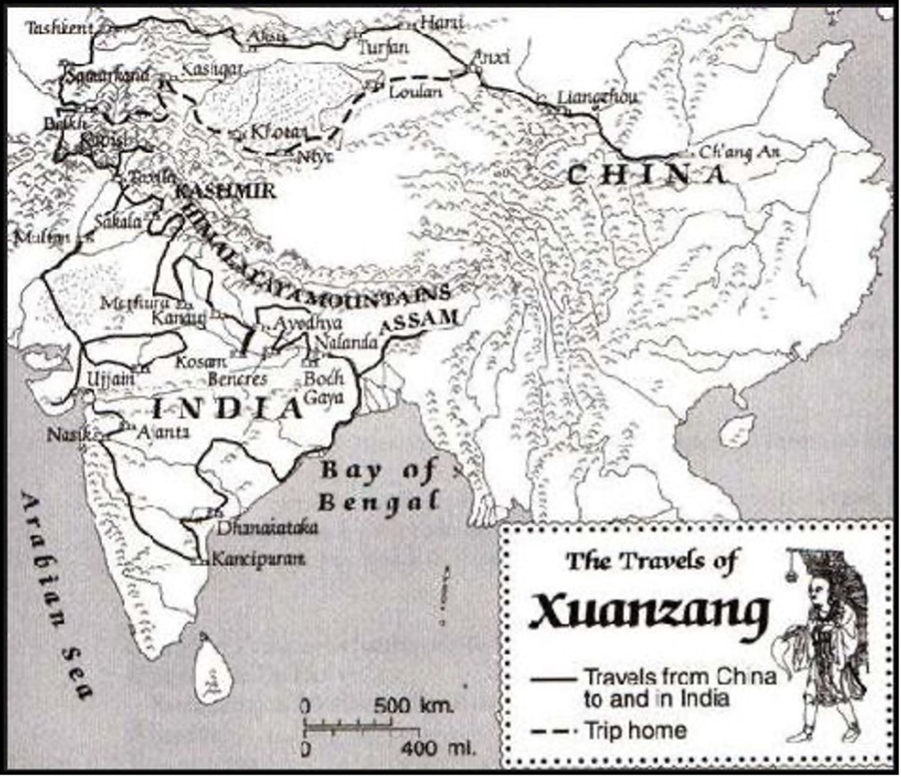
Map of the Travels of Xuanzang (629 AD - 645 AD) Journey to the West

Annotation
This Schematic Map shows the entire "Journey to the West" as made by the Chinese Monk Xuanzang (Hsüan-tsang) on the Silk Road between China and India in the years 629 AD to 645 AD. The Path of the Journey to led from the Chinese Capital in Shaanxi Province of China acros the Yellow River to the westernmost pass of the Great Wall of China. Via Xinjiang it continued into Kyrgyzstan, Uzbekistan, Tajikistan, Afghanistan, Pakistan and India. The Return Journey led through current day Pakistan and Afghanistan to reach Kashgar in current day Xinjiang-Uyghur Autonomous Region of China. Because the (Han) Chinese Cultural Zone during the Tang Dynasty Era only reached as far as Dunhuang, where the Great Wall of China began, Xuanzang had to travel south-east from Kashgar via Yarkant and Hotien (Khotan) along the South Route around the Taklamakan Desert to finally return to his native China in 645 AD. Xuanzang died as a National Hero in 661 AD.
This annotation comes from The China Report.
This source is a part of the Cultural Exchange Before Modern Times teaching module.